Photogrammetry is a fascinating blend of art and science that has gained significant importance in today’s technology-driven world. By capturing overlapping images of objects or landscapes and using these to create accurate 3D models, photogrammetry allows us to measure and analyze spaces with high precision. This technique not only simplifies how we document real-world environments but also enables advancements across various fields, from architecture to environmental science.
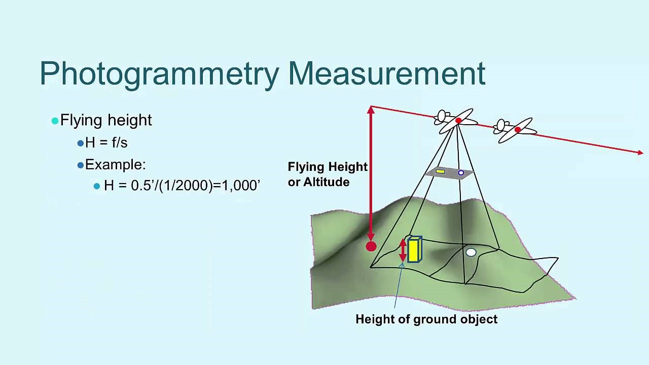
Photogrammetry is an imaging technique that allows us to create accurate models, maps, or measurements of real-world objects and spaces. This technique uses the science of capturing and analyzing overlapping photographs from different angles to measure distances, dimensions, and spatial relationships. It involves specialized software and algorithms that interpret visual data and transform it into reliable digital models.
Defining Photogrammetry
At its core, photogrammetry is the process of measuring and analyzing photographs to extract detailed, measurable information about physical environments. Through image capture and data processing, photogrammetry reconstructs three-dimensional spaces from two-dimensional images. This science-based technique leverages cameras, drones, and other devices to create accurate models of everything from small objects to entire landscapes.
For example, surveyors may use photogrammetry to create maps of a construction site, while archaeologists might document historical structures for preservation efforts.
The Types of Photogrammetry
There are different types of photogrammetry, each suited to specific applications. Here’s a breakdown:
- Terrestrial Photogrammetry: This involves capturing images from the ground and is typically used in projects where detail is required over a smaller area. Applications include architectural surveys, crime scene investigations, and detailed modeling of small objects.
- Aerial Photogrammetry: Using cameras mounted on drones, planes, or helicopters, aerial photogrammetry covers large areas and is commonly used for topographic mapping, urban planning, and environmental monitoring.
- Close-Range Photogrammetry: This type focuses on capturing images from close proximity, making it ideal for creating detailed 3D models of small objects or scenes. It’s often used in industries such as manufacturing and forensics.
Each type of photogrammetry has unique strengths, and choosing the right type is crucial depending on the scale and detail required in the project.
Key Technologies Enabling Photogrammetry
The success of photogrammetry depends on advanced equipment and powerful software. Here’s an overview of the essential technologies:
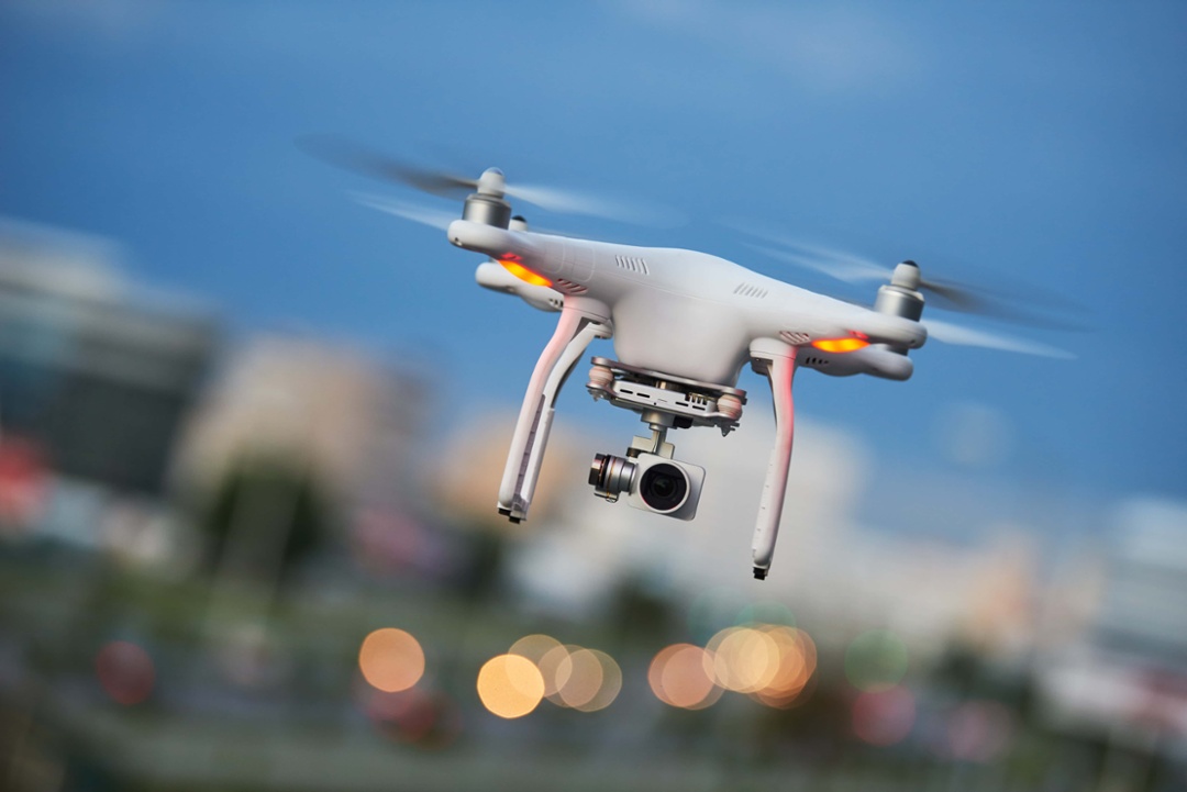
- Cameras and Drones: High-resolution cameras and drones are the primary tools for image capture. Drones, in particular, have transformed photogrammetry by enabling aerial imaging over large and inaccessible areas.
- Global Positioning System (GPS): GPS is essential in photogrammetry for geolocating images, ensuring accurate spatial positioning of the captured data.
- Software for Data Processing: Specialized software like Pix4D, Agisoft Metashape, and Autodesk ReCap transform raw images into 3D models. These platforms use complex algorithms to stitch images together and calculate measurements, delivering precision in model creation.
By combining these technologies, photogrammetry produces results that are both visually accurate and metrically reliable, making it a powerful tool across industries.

Where Is Photogrammetry Used? Key Industries and Applications
Architecture and Urban Planning
Photogrammetry has become an invaluable tool in architecture and urban planning, revolutionizing how we design, construct, and manage our built environment. By capturing detailed 3D models of existing buildings and landscapes, photogrammetry allows architects, planners, and engineers to gain deep insights into structures and urban layouts. With this technology, they can make informed decisions that improve efficiency, sustainability, and safety.
Building Information Modeling (BIM) and Digital Twins
One of the most prominent uses of photogrammetry in architecture is in the creation of Building Information Modeling (BIM) and Digital Twins. By using photogrammetry to create accurate 3D models of real-world buildings, architects and engineers can build detailed BIM models that represent every physical component within a structure. These models provide a comprehensive digital representation, allowing professionals to simulate and optimize building operations.
Examples of BIM Applications:
- Energy Efficiency Analysis: Photogrammetry captures accurate building data, allowing engineers to analyze energy use and optimize HVAC systems for reduced environmental impact.
- Structural Health Monitoring: Digital Twins created from photogrammetry data can track a building’s structural integrity over time, flagging areas for maintenance before issues become severe.
Digital Twins serve as dynamic models that are continuously updated to reflect the real-world status of buildings. They’re especially useful in managing large-scale projects, from office buildings to entire city districts. Through BIM and Digital Twins, photogrammetry contributes to efficient design, construction, and maintenance processes, ultimately reducing costs and promoting sustainability.
Preservation of Historical Sites
Preserving historical landmarks is another area where photogrammetry proves invaluable. It allows historians and conservationists to create accurate digital records of heritage sites, providing a detailed reference that can be used for restoration efforts or virtual tourism. Given that many historical sites are vulnerable to weathering, natural disasters, or even human activity, photogrammetry offers a way to capture these spaces with unparalleled precision, safeguarding cultural heritage for future generations.
Case Study: Preservation of Petra, Jordan: In a recent project, photogrammetry was used to create a digital replica of the ancient city of Petra, a UNESCO World Heritage site. With drones and high-resolution cameras, researchers captured thousands of images to reconstruct the city in 3D. This digital archive not only preserves Petra’s structures but also allows researchers worldwide to study the site remotely, reducing the impact of tourism on fragile areas.

Construction and Engineering
In construction and engineering, photogrammetry is instrumental in ensuring that projects are completed accurately, efficiently, and on time. By enabling project managers to capture real-time, high-precision data of construction sites, photogrammetry supports monitoring, measuring, and managing various aspects of the construction process. This helps in reducing errors, lowering costs, and ensuring that the finished structures meet rigorous standards.
Project Monitoring and Site Analysis
One of the key applications of photogrammetry in construction is project monitoring. Through aerial photogrammetry, project managers can conduct regular site surveys that capture progress data in high detail. Drones equipped with high-resolution cameras can survey large construction sites within minutes, providing a comprehensive view of ongoing work without interrupting operations on the ground.
Benefits of project monitoring with photogrammetry include:
- Accurate Progress Tracking: By capturing images at different stages of construction, managers can create a chronological record of the project. This allows for precise monitoring of whether the project is on schedule or if there are delays.
- Identifying and Resolving Issues Early: Photogrammetry data can reveal discrepancies between the design and the actual construction, allowing for timely corrections and avoiding costly rework.
- Improved Collaboration: With photogrammetry models accessible to all project stakeholders, teams can better coordinate and make informed decisions, ensuring everyone is aligned.
Example: In a large bridge construction project, photogrammetry was used to survey the site daily. This data allowed engineers to assess the construction’s alignment with the design plans and adjust accordingly, keeping the project on track and ensuring safety standards.
Volume and Distance Measurement
Another critical application of photogrammetry in construction is in measuring volumes and distances. Accurate volume measurement is essential in projects involving significant earthworks, such as excavations or road building. Traditional methods for volume measurement are time-consuming and can be prone to error, but photogrammetry offers a quicker and more accurate solution.
Key uses for volume and distance measurement include:
- Calculating Excavation Volumes: By creating 3D models of the excavation site, engineers can calculate the volume of earth removed or required, allowing for more efficient resource allocation.
- Stockpile Measurement: Photogrammetry allows for accurate measurement of stockpile materials (e.g., gravel, sand) without physical measurement, saving time and reducing the risk of human error.
- Distance and Height Analysis: The 3D models generated allow for precise measurements of distances and heights, crucial for infrastructure projects that require exact dimensions.
Using photogrammetry, construction teams can make critical calculations that ensure accuracy in materials management, reducing waste and optimizing resources.

Land Surveying and Mapping
Land surveying and mapping is one of the oldest applications of photogrammetry, and it continues to be a vital tool for professionals in this field. By enabling surveyors to capture precise spatial data over large areas, photogrammetry makes it possible to create topographic maps, terrain models, and geographic information systems (GIS). These tools are essential for urban planning, environmental studies, infrastructure development, and resource management.
Creating Topographic Maps
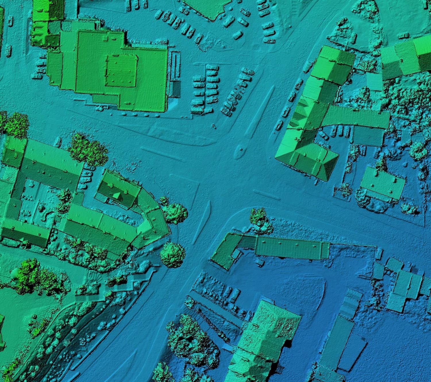
Topographic maps represent the physical features of an area, including its elevation, terrain, and landmarks. Traditionally, creating these maps required extensive fieldwork, often in challenging or inaccessible areas. Photogrammetry has significantly simplified this process, especially with the use of drones and aerial imaging.
Key advantages of photogrammetry in topographic mapping include:
- High Accuracy: Photogrammetry captures intricate details of the terrain, resulting in maps that accurately reflect changes in elevation, slopes, and natural formations.
- Time Efficiency: Using aerial photogrammetry, large areas can be surveyed quickly, reducing the time and labor involved compared to traditional ground surveys.
- Accessibility to Remote Areas: Photogrammetry can capture data in places where physical access is difficult, such as rugged mountains or dense forests, making it possible to map areas that were previously challenging to survey.
Example of Topographic Mapping with Photogrammetry: In the construction of new railways or highways, photogrammetric topographic maps help engineers understand the terrain, allowing for precise planning that minimizes environmental impact and reduces costs associated with earthworks.
Geographic Information Systems (GIS)
Photogrammetry also plays a crucial role in developing and updating Geographic Information Systems (GIS). GIS platforms integrate data from multiple sources to create comprehensive, interactive maps used in fields like urban planning, agriculture, forestry, and disaster management. Photogrammetry provides the highly accurate, spatially referenced data that GIS systems rely on, enhancing the depth and usability of these maps.
Applications of GIS with photogrammetry include:
- Urban Development Planning: By integrating photogrammetry data into GIS, urban planners can model existing infrastructures, forecast growth, and make informed decisions on zoning, transportation networks, and utilities.
- Environmental Management: Photogrammetry-based GIS maps aid in tracking environmental changes, including deforestation, desertification, and water body management. This data helps governments and organizations make strategic conservation decisions.
- Agriculture and Land Use Mapping: With photogrammetry, farmers can use GIS to monitor crop health, track soil conditions, and plan resource usage, contributing to more sustainable agricultural practices.
The combination of photogrammetry and GIS has transformed how we manage and understand our landscapes, providing data-driven insights that guide everything from city planning to environmental conservation.